Peru: Inca Trail. Sept. 1-3, 2007

Postby Tony Crocker » Mon Nov 05, 2007 5:59 pm

We hiked the Inca Trail from Sept. 1-3.
090107_map.JPG
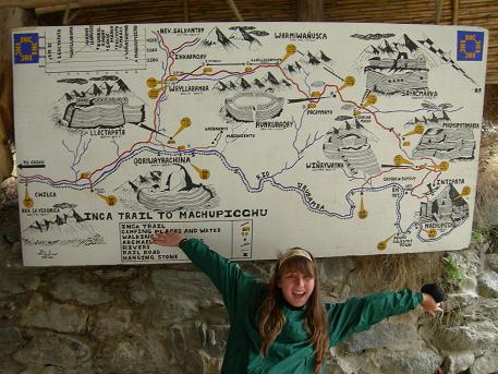
Map of the 30 mile trail. First day is an easy walk from about 8,800 to camp at 9,800 feet.
090107_map.JPG (50.06 KiB) Viewed 1587 times

090107_llactapata.JPG
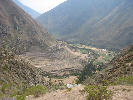
Llactapata Inca town and farming terraces viewed from above on the first day.
090107_llactapata.JPG (42.79 KiB) Viewed 1611 times

090207_passclimb.JPG
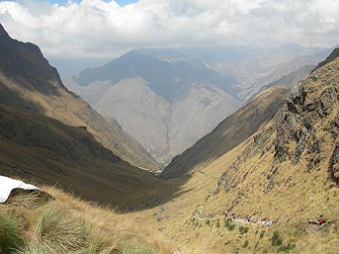
Adam took this pic of ascending hikers from the highest point of the Inca Trail at 13,800 ft.
090207_passclimb.JPG (39.02 KiB) Viewed 1611 times

090207_passdown.JPG
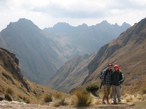
Adam and Aislinn ready to descend to camp.
090207_passdown.JPG (33.26 KiB) Viewed 1609 times

090207_pacaymayo.JPG
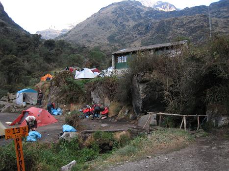
Sept. 2 campsite at about 12,000 ft. Bridge over cold flowing stream with our porters on the other side.
090207_pacaymayo.JPG (48.15 KiB) Viewed 1610 times

090307_fog.JPG
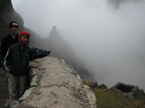
There was patchy fog early in the morning of the 3rd day, here at the small Inca checkpoint Runkuracay.
090307_fog.JPG (25.38 KiB) Viewed 1610 times

090307_runkuraoay.JPG
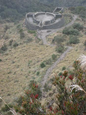
View of the checkpoint from above.
090307_runkuraoay.JPG (46.06 KiB) Viewed 1609 times
Last edited by Tony Crocker on Tue Nov 06, 2007 8:59 am, edited 2 times in total.
http://bestsnow.net
Ski Records
Season length: 21 months, Nov. 29, 2010 - July 2, 2012
Days in one year: 80 from Nov. 29, 2010 - Nov. 17, 2011
Season vertical: 1,497K in 2016-17
Season powder: 291K in 2011-12
User avatar
Tony Crocker
 
Posts: 9405
Joined: Thu Sep 23, 2004 10:37 am
Location: Avatar: Charlotte Bay, Antarctica 2011
Location: Glendale, California
Top

re: Peru: Inca Trail

Postby Tony Crocker » Mon Nov 05, 2007 6:14 pm

More pics from Sept. 3 on the Inca Trail. On this day there are more Inca archaeological sites, and the most of the paved trail is original Inca construction. The trail is closed in February (also rainiest month) for maintenance.
090307_andrew.JPG
Andrew got sick with the 4,000 foot second day climb plus sleeping at 12,000, and thus had a rough 3rd day.
090307_andrew.JPG (57.48 KiB) Viewed 1586 times

090307_2ndpass.JPG
View of the trail near the 13,000 ft highest point of the 3rd day.
090307_2ndpass.JPG (39.28 KiB) Viewed 1608 times

090307_sayacmarca.JPG
I'm at Sayacmarca, about 100 feet above the trail. Lunch was at the rest stop at distance center right.
090307_sayacmarca.JPG (39.14 KiB) Viewed 1608 times

090307_sayacmarca2.JPG
Aislinn took this picture of Adam through one of the holes the Inca's made to support wooden barriers at Sayacmarca.
090307_sayacmarca2.JPG (33.98 KiB) Viewed 1608 times

090307_phuyupatamarka3.JPG
Aqueduct built to irrigate terraces at Phuyupatamarka is still functional.
090307_phuyupatamarka3.JPG (58.79 KiB) Viewed 1608 times

090307_phuyupatamarka.JPG
I listened to one of the Andean guides for a while at the top of this site.
090307_phuyupatamarka.JPG (49.47 KiB) Viewed 1609 times
Attachments
090307_phuyupatamarka2.JPG
Inca Trail begins a steep 3,000 vertical descent of many steps on the backside of Phuyupatamarka.
090307_phuyupatamarka2.JPG (59.08 KiB) Viewed 1607 times